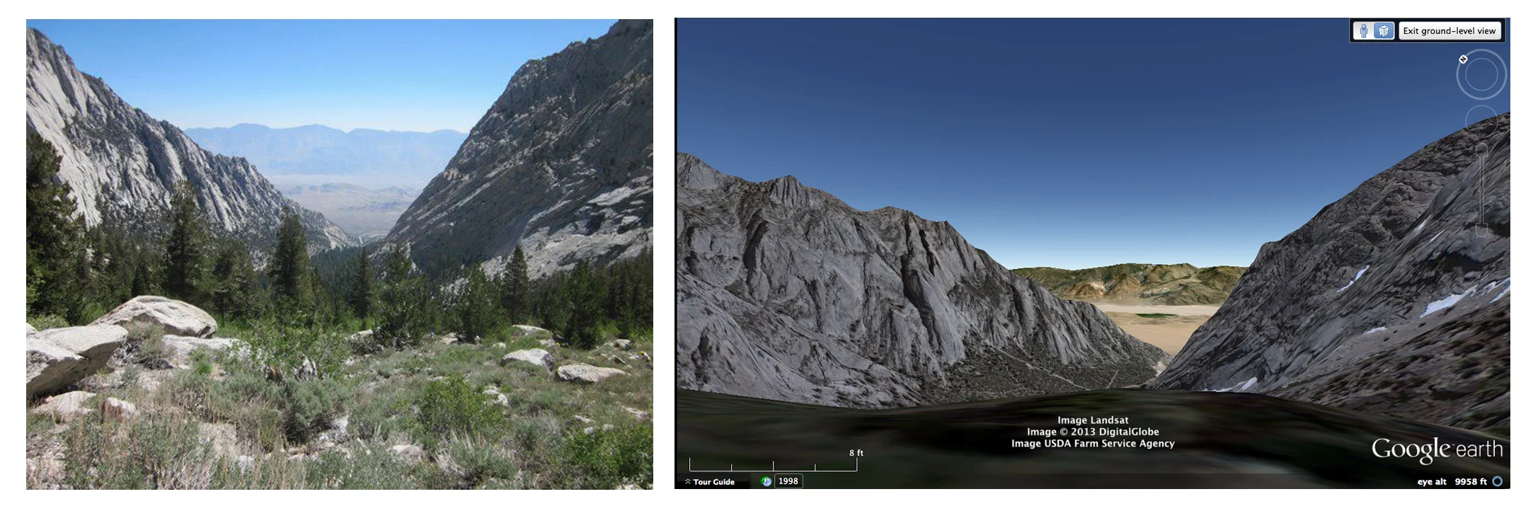
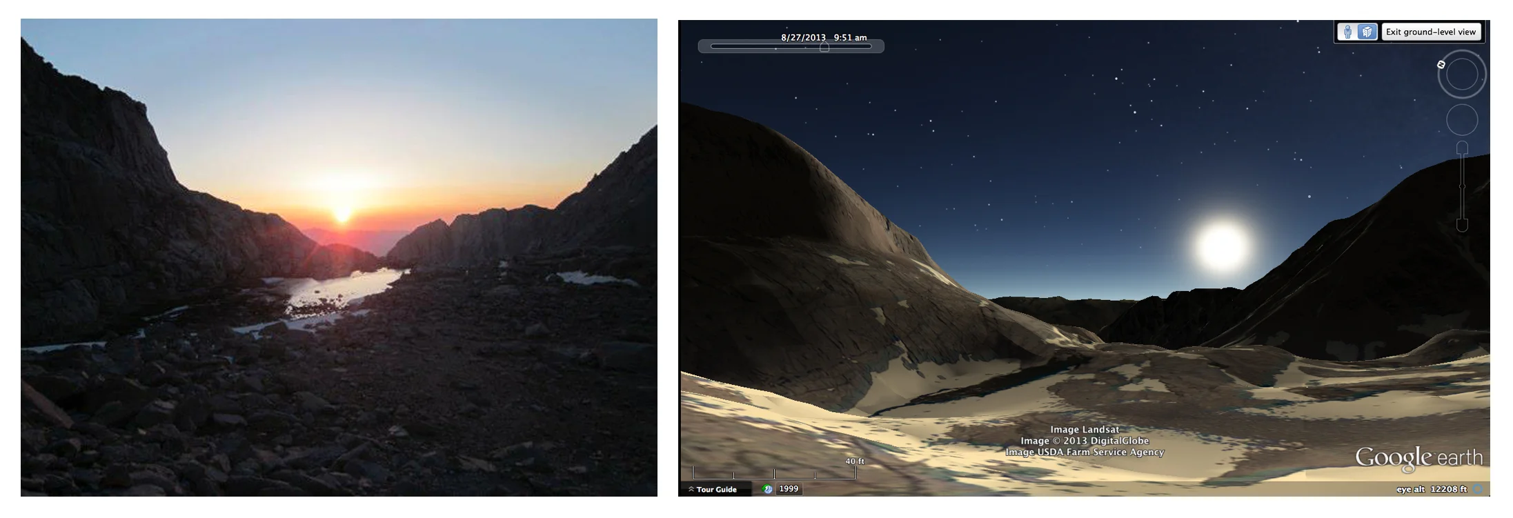
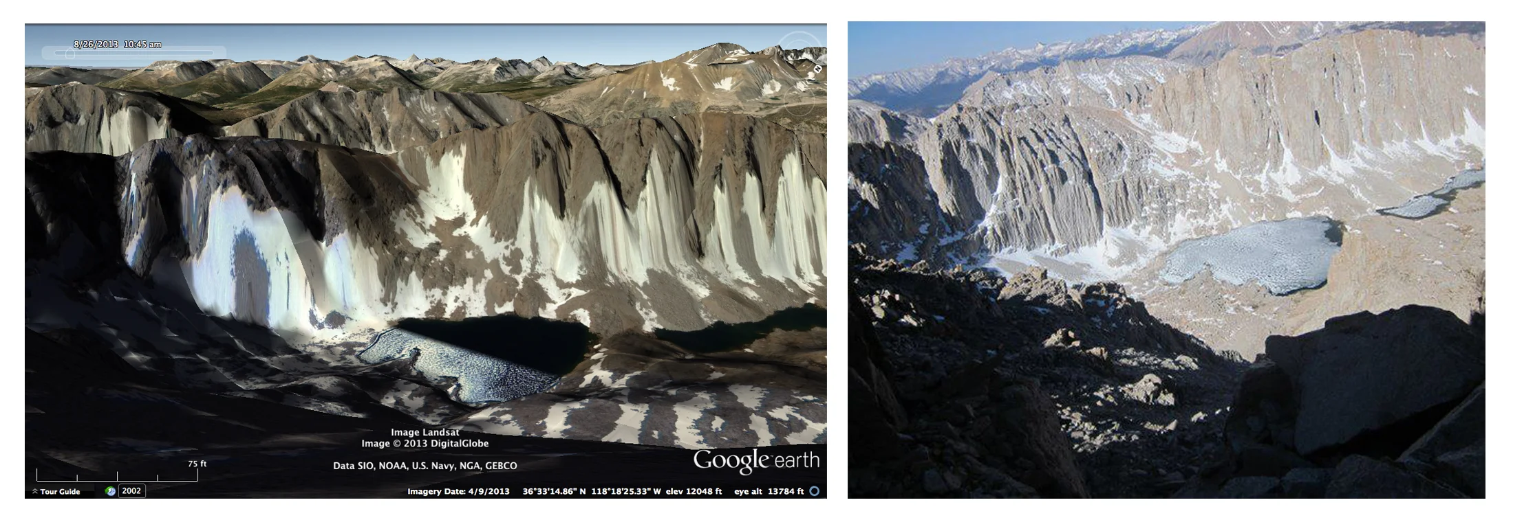
Mt. Whitney, the tallest point in the contiguous U.S., rises out of the Sierra Nevada fault-block upwards to 14,505 ft. Its also the closest to space that I'm able to get to at the present moment.
Some other basic facts about the mountain:
The granite that composes Whitney was formed during the Cretaceous (145-60 MYA) and was slowly and violently pushed into the sky by the twisting and rotating of the Sierras and the stretching and spreading of the Great Basin. From the view point of a satellite, this would look something like stretch marks. All this happened between 2 and 10 million years ago. Before their eradication, the local Paiute Indians believed that The Great Spirit resided with the mountain, watching over the land and people. They called the peak Too-man-go-yah-, or 'very old man'. The white man calls the mountain, Mt. Whitney, after Josiah Whitney a California Geologist and another white man. The first men (in 'recorded history') to reach the top of the peak called it 'Fisherman's Peak', as they were local fisherman from Lone Pine, a small town at the base of the Alabama Hills below Whitney. The first trail to the summit was completed on July 02, 1904 and paid for by residents of Lone Pine. The first recorded death on the mountain occurred just 4 days later. Nowadays, the main trail is one of the most popular hiking routes in the US and you can get perfect cell reception from the top of the summit. You can also hear airplanes flying over regularly, reminding you that wilderness is still a myth, even above the tree line. Lastly, you can, using Google Earth, obsessively explore the mountain from the comfort of your home, making the summit without ever getting off the couch.
Remote sensing and the invention of the satellite has enabled our species something entirely novel: the ability to see the earth from space and the ability to watch the whole earth change over time. Sensors attached to satellites in space have undoubtedly proved that we, as a species, have made an impact on our planet that is threatening our own survival. Most mammalian species tend to survive around 2 million years and according to the Copernican Principle, we are destined to be around for a minimum of five or so thousand years, with a maximum of a few more million years.
Google Earth reconstructions are limited by the resolution of the sensors attached to the satellites. As technology advances of course, something called the Ground Sample Distance (relationship of a pixel to a quantity of area on the ground) will eventually reach enough of a 1:1 ratio to call up Bonini's paradox . One pixel to one inch, One pixel to one cm, One pixel to one mm, ad infinitum. The greater the resolution, the more meaningless the representation becomes. It makes me think of Borges:
In time, those Unconscionable Maps no longer satisfied, and the Cartographers Guild drew a Map of the Empire whose size was that of the Empire, coinciding point for point with it. The following Generations, who were not so fond of the Study of Cartography saw the vast Map to be Useless and permitted it to decay and fray under the Sun and winters.
In the Deserts of the West, still today, there are Tattered Ruins of the Map, inhabited by Animals and Beggars; and in all the Land there is no other Relic of the Disciplines of Geography. - From On Exactitude and Science
Google Earth has a history scrubbing tool, allowing you to transport back into geographic time. As you travel further back, the resolution becomes lower and the world within GEarth becomes more and more abstract and fantastical. GEarth gets its images from government satellite programs as well as private companies such as GeoEye and Digital Globe. GeoEye-2 currently has the best resolution for commercial imaging, approximately 9.8 inches per pixel from a distance of 423 miles. Interestingly enough, because of Government regulations, GeoEye can only release images up to a little over 19 in resolution (50 cm).
RAND corporation wrote a paper in 1946 entitled A preliminary Design of a World-Circling Spaceship in which they outline the cultural and technological implications of putting a satellite into orbit. They also anticipated the Cold War in their analysis of if a foreign power were to beat the US in such an achievement.
Its amazing to me that less that 70 years ago, the worlds most sophisticated think tank dreamed up a machine that would circle the earth and take pictures of it and now each and everyone of us can see our world from the perspective of this machine. For free! This is truly astonishing. What is more astonishing, is imagining what we, if we survive, a million years from now, could watch a movie of the earth changing over time from the POV of a satellite. This is a ridiculous idea that has possessed me for almost two years. So much so, I almost made it the subject of my graduate thesis. Since discovering RANDs paper, I think I may have found a format for the manifestation of this obsession.